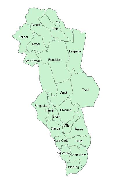
Abruozdielis:Hedmarkskommuner.jpg
Parvaizos dėdloms: 375 × 598 pikselē. Kėtė dėdlomā: 150 × 240 pikselē | 396 × 632 pikselē.
Pradėnis abruozdielis ((396 × 632 taškū, faila dėdoms: 39 KiB, MIME tips: image/jpeg))
| Tas abruozdielis īr ėš Vikitėkuos arkīvu. Anuo orėgėnalos aprašėma poslapis īr čiuonās. |


Created in ArcMap by Mahlum 21:41, 26 August 2005 (UTC)

|
Douts ī leidėms parsineštė, vėišintė ė/aba mainītė tou dākta palē GNU Free Documentation lėcencėjė, atmaina 1.2 aba bikuokė vielībesnė lėcencėzjė ėš Free Software Foundation; ba nakeitamu skėrsniu, ė tekstu, dedamu ont pėrma ė ožpakalėnė viršeliu. Lėcencėjės kuopėjė itraukta i skėrsni, ožvadinta GNU Free Documentation License. |
| Ta skvarma prėgol vagol Creative Commons Attribution-Share Alike 3.0 Unported lėcencėjė. | ||
| ||
| Licencijos šablonas buvo priskirtas šiam failui kaip GFDL licencijos atnaujinimo dalis. |
Abruozdielė istuorėjė
Paspauskėt ont deinas/čiesa, ka paveizietomėt abruozdieli, kāp ons ėšruodė pradiuo.
| Dėina/Čiesos | Pamažėnėms | Mierā | Nauduotuos | Paāškėnėms | |
|---|---|---|---|---|---|
| vielībs | 00:41, 27 rogpjūtė 2005 | | 396 × 632 (39 KiB) | Mahlum | Created in ArcMap by ~~~~ {{GFDL}} Category:Maps of Hedmark |
Abruozdieliu nauduojėms
Ons poslapis ruod ton abruozdielin:
Abruozdielė nauduojėms vėsor
Tėi viki poslapē nauduo šėton abruozdieli:
- Skvarmas nauduojėms azb.wikipedia.org
- Skvarmas nauduojėms bs.wikipedia.org
- Skvarmas nauduojėms da.wikipedia.org
- Skvarmas nauduojėms de.wikipedia.org
- Skvarmas nauduojėms en.wikipedia.org
- Skvarmas nauduojėms eo.wikipedia.org
- Skvarmas nauduojėms es.wikipedia.org
- Skvarmas nauduojėms et.wikipedia.org
- Skvarmas nauduojėms hr.wikipedia.org
- Skvarmas nauduojėms hu.wikipedia.org
- Skvarmas nauduojėms ka.wikipedia.org
- Skvarmas nauduojėms ko.wikipedia.org
- Skvarmas nauduojėms lt.wikipedia.org
- Skvarmas nauduojėms nl.wikipedia.org
- Skvarmas nauduojėms nn.wikipedia.org
- Skvarmas nauduojėms no.wikipedia.org
- Skvarmas nauduojėms pl.wikipedia.org
- Skvarmas nauduojėms pt.wikipedia.org
- Skvarmas nauduojėms ru.wikipedia.org
- Skvarmas nauduojėms sr.wikipedia.org
- Skvarmas nauduojėms sw.wikipedia.org
- Skvarmas nauduojėms zh.wikipedia.org